
In 1973, Gunther W. Holtorf was assigned as the manager of Lufthansa in Indonesia.
From his first year working in Jakarta, many friends and visitors from abroad frequently asked him to act as their guide in the city. To assist his guests, despite having no formal background in cartography, he began sketching maps of Jakarta. His work proved useful and well-received, encouraging him to create a more detailed and comprehensive map of the city.
To achieve this, he initially approached the Jakarta City Planning Office. Instead of obtaining the topographic maps he sought as a base, he only found outdated maps of the city. This situation led the local civil servants to encourage him to produce a new map.
Gunther accepted the challenge. Every weekend, he explored Jakarta, navigating its narrow alleys and streets by foot, bicycle, and car. In addition to his weekend excursions, he also dedicated time each morning from 6:00 to 9:00 before heading to his office.
Throughout his explorations, he experienced various encounters. On one occasion, while passing through Tanah Abang and Tanjung Priok, his car’s tires were punctured by nails deliberately scattered on the road by robbers, who then seized his bag and equipment.
However, he also received warm welcomes from local residents. He was frequently approached by people who recognized him, particularly those who spoke English or German. “Hey, aren’t you the foreigner who was here last year?” he recalled hearing from friendly locals.
Finally, in 1977, coinciding with Jakarta’s 450th anniversary, his first map was completed. The 40x40 cm map—referred to by Holtorf himself as a “children’s map”—was presented to Jakarta’s governor, Ali Sadikin. Lacking professional training in cartography—his background being in economics—Holtorf entrusted the actual cartographic production to Cartographia, a Budapest-based company in Hungary.
The map covered areas from Ancol to Jalan Gatot Subroto. Since Holtorf resided in Kemang, he included a small portion of that neighborhood as well. However, districts such as Pasar Minggu and Kalibata were omitted, as he humorously considered them to be “foreign territory.”
Despite its simplicity, Ali Sadikin welcomed the map enthusiastically, as no previous map had depicted Jakarta in such detail.
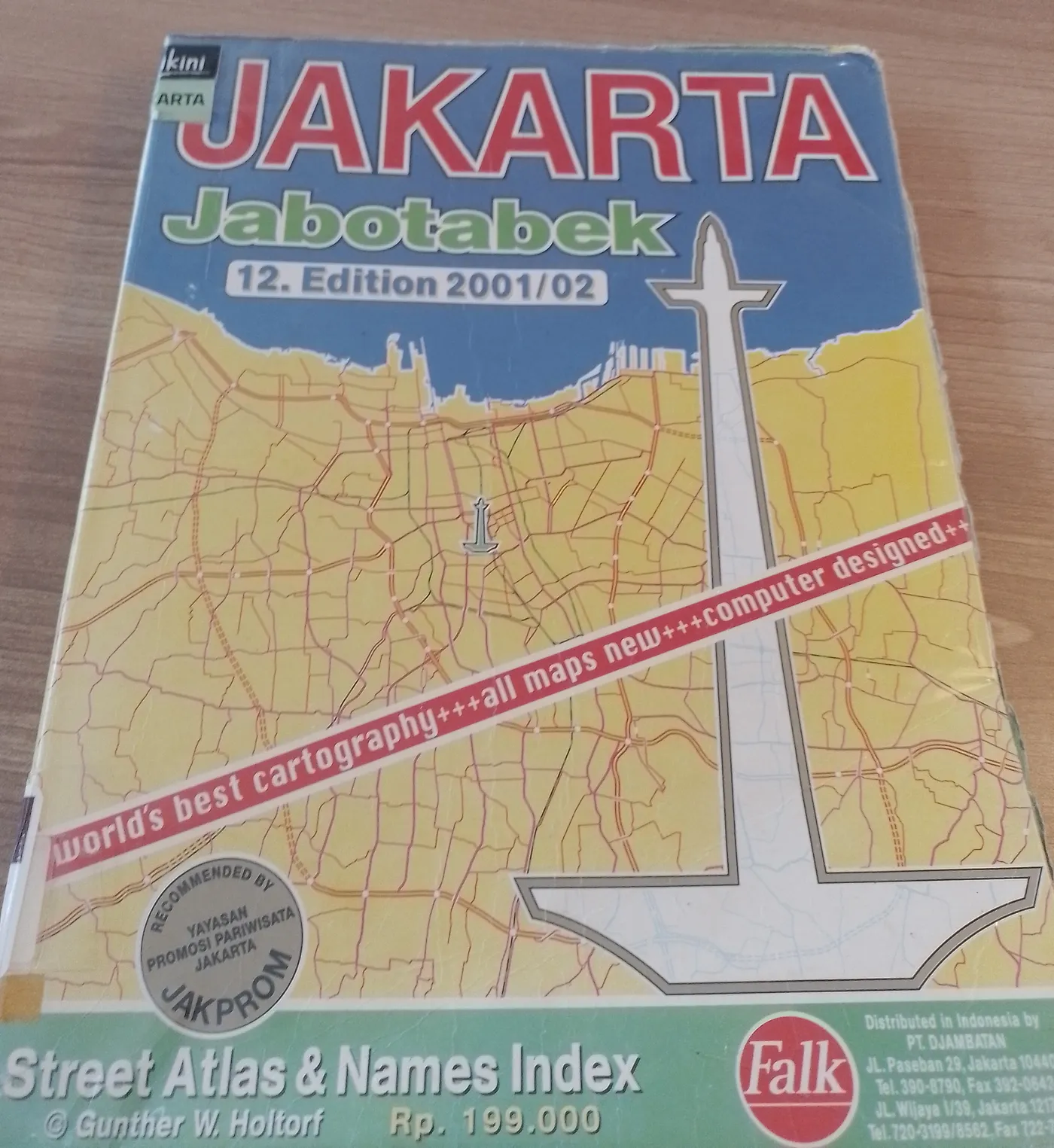
By 2001, Holtorf’s Jakarta map had reached its twelfth edition, covering a much larger area. The southern boundary extended to Puncak, the eastern to Karawang, and the western to Tangerang. Each time a new edition was released, Holtorf personally verified Jakarta’s ever-changing landscape, a process that often took months. His sources of information had also expanded, including data from the National Coordinating Agency for Surveys and Mapping (Bakosurtanal), the Ministry of Public Works, Jasa Marga, and property developers.
References
- Irfan Teguh Pribadi (September 12th, 2018) “Nasib Buntung Peta Gunther di Zaman Google Maps” Tirto
Discussion