
Growing features and making OSMCha operationally excellent
Posted by wille on 17 December 2020 in English.OSMCha helps analyze, inspect, and verify changes in OpenStreetMap as they happen. The entire team building OSMCha has been proud to see its wide adoption by individual contributors and companies in the OpenStreetMap community. I continue working on OSMCha through support from Mapbox, who have been using and helping develop and host OSMCha for years. The Mapbox Data RAVE team uses OSMCha everyday as part of their work validating changes in OpenStreetMap.
That’s why it’s essential that OSMCha is operationally excellent, with dependable uptime and a team on hand to handle issues and deployments. Since the beginning of the year, I worked closely with the “RAVE tooling” team to improve the infrastructure setup for OSMCha for better performance, instituted on call support, and moved the service to the osmcha.org domain. I continue to work hard to maintain the OSMCha open source code base and community and develop new features. There’s many useful new features and more to come.
Improved Visualization

Relations are complex elements in OpenStreetMap, used to define features like a cluster of buildings in a compound, administrative boundaries and turn restrictions. Relations are now visualized in OSMCha, making it easier to understand these changes.

Another hard change to show in OpenStreetMap is when a single node of a linear feature is dragged on the map. OSMCha now visualizes these changes.
Better metadata search
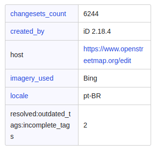
When OpenStreetMap editors commit a change, metadata is recorded like the language of the browser and number of previous edits made by the user, the software used and the number of validation issues solved. These are important signals to consider when assessing quality of edits. OSMCha search is now more powerful than ever and allows you to filter changesets on all that metadata. For example, changesets created by users with less than 50 edits; with the Portuguese locale; or with the #hotosm-project hashtag. The documentation has more information about using metadata filters.
Microtasking with MapRoulette
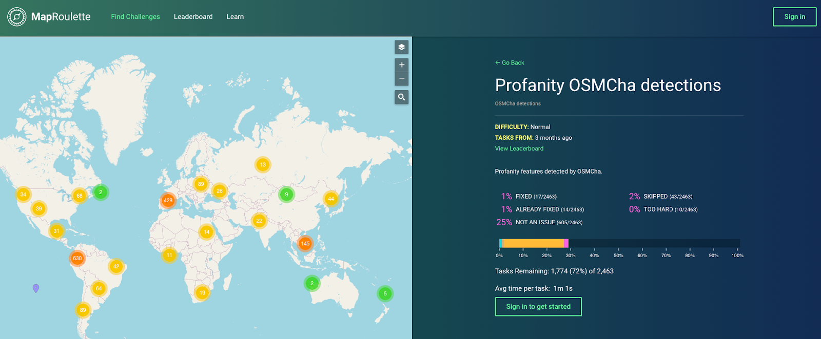
OSMCha not only helps detect issues, but leads to fixing them. We’ve recently integrated with the MapRoulette microtasking service to create challenges from issues flagged by OSMCha. This integration provides another way to validate and fix data problems. Check out the OSMCha challenges available on MapRoulette.
What’s next
Our plans are growing for OSMCha in the next few months. We’re improving search to filter edits by changeset comments, polishing the front end to improve the experience, and researching the accuracy of automated tags in OSMCha to improve the efficiency of these checks.

Start using OSMCha right now. Simply sign in with your OpenStreetMap account. And let me know if you have any feedback in OSMCha’s GitHub issue tracker.
Discussion
Comment from PierZen on 18 December 2020 at 14:34
Hi Wille,
It would be great if some backstore work was done to complete Changeset metadata from the Planet file, adding infos about the type of edit. I dont think that such info is yet available.
objects edited - buildings - roads - waterways - landuse - Administrative polygons etc.
Actions new, modifiy, delete
This would add a lot more flexibility about analyzing edits / spot problems.
Comment from PierZen on 18 December 2020 at 17:20
Type of edit could be also identified such as imports, organized editing to facilitate monitor these activities.
Comment from RicoElectrico on 19 December 2020 at 13:42
Hi,
I messaged you about a problem a while ago. Admin boundaries for filters are very very crude. When I type ‘pomorskie’ and select “województwo pomorskie” the boundary is simplified too much and misses much area of the coast. Moreover, the boundaries are simplified without regard to topology (“województwo zachodniopomorskie”) doesn’t have a matching boundary with it.
Hope it’s possible to fix this! Maybe you could re-generate boundaries with MapShaper library, it takes care of topology with way less issues than GRASS for instance.