
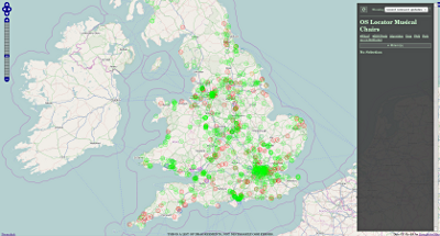
Ordnance Survey have recently released their November 2014 version of OS Locator, the comprehensive gazetteer for GB. According to my calculations there are 12,201 new or changed entries and 10,203 removed entries since the last release in May.
I’ve updated my comparison tool Musical Chairs with the new data. New entries tend to show up prominently in the “recent relevant updates” view mode for a week or so after an update, so this is a good way of taking a look at what’s changed in your area.
I’d suggest GB mappers take a look at their area, even if not for the purpose of mapping - new releases of Locator often reveal some interesting things about new building projects and developments.
Additionally, I’ve recently added RSS feeds to musical chairs to make it even easier to monitor your area for possibly problematic changes.
Discussion
Comment from chillly on 22 November 2014 at 13:04
There are the usual, strange anomalies that OS Locator throws up. A correctly named road in OSM with two OS Locator anomalies, a well-known, substantial residential road which OS Locator has flagged as wrongly named in the past with a name of a tiny side road, now flagged up a different variant of that tiny road name, again wrongly. The names in the high quality OS map datasets are not wrong at all, so where do OS get these bonkers anomalies from in their Open Data?
ITO publish a list of completeness based on OS Locator as well as Robert’s Musical chairs. They both provide a useful view, particularly showing new developments or changes that need surveying. Many authorities in the ITO List show a high degree of completeness, yet they have very few anomalies (highlighted using not:name). This, IMHO, means OS Locator names are being used in OSM without checking them on the ground. This is perpetuating OS’s inexplicable errors into OSM and need to be avoided by surveying.
Thanks to Robert and ITO for their respective, complimentary approaches to display this undeniably useful open data, but lets not abuse this by just copying it unchecked.
Comment from James Derrick on 28 November 2014 at 08:06
Hi Robert,
Thanks for the hard work behind this tool!
I find a combination of both the ITO Analysis tool and your Musical Chairs tool invaluable to keep my local area up to date.
Blyth Valley, Wansbeck, Castle Morpeth, Alnwick and North Tyneside are all getting back to 100% with your help and physical surveys to amend or to mark with not:name tags.
The ITO tools give a good numerical analysis by county area (UK Percentage Complete 98.00%), and an overlay which can be used directly in JOSM for comparison with OSM data and Bing imagery.
Your Musical Chairs tool is useful as it explains the data and logic behind a match in the sidebar, and is updated much more reguarly. I also appreciate the time you’ve taken to explain your algorithm, and extra features like the RSS feed which I intend to experiment with.
If the RSS feed can list diffs within a bounding box, could the processing produce a GPX file with the centroids of the non-green issues? I guess some areas could produce a very large query, but something directly loadable into a survey GPS would give paperless To Do list.
Thanks for your efforts.
Comment from robert on 28 November 2014 at 18:27
Ahoy there James,
I do produce a gzipped csv of the results (http://wiki.openstreetmap.org/wiki/OS_Locator_Musical_Chairs#Can_I_have_a_dump_of_the_data.3F) which I know Derick Rethans (http://www.openstreetmap.org/user/Derick%20Rethans) for one uses to produce something like a GPX for his Garmin. Knowing him he has some php script for doing it.
Comment from Derick Rethans on 28 November 2014 at 23:57
Actually, I don’t make a GPX of it, but an .osm file, which I feed into mkgmap to create a Garmin file. The scripts are at https://github.com/derickr/osm-tools/tree/master/musical-chairs-to-garmin
Comment from robert on 28 November 2014 at 23:58
Apparently he just has code to turn it into .osm files. Here: https://github.com/derickr/osm-tools/tree/master/musical-chairs-to-garmin
Conversion to gpx wouldn’t be a difficult hack. Good beginner project.
Comment from robert on 28 November 2014 at 23:59
^Heh.
Comment from robbieonsea on 29 November 2014 at 00:59
Note that gpsbabel can convert .osm files into GPX files.
See: http://www.gpsbabel.org/htmldoc-development/fmt_osm.html