
Announcing Street Spirit: A new OpenStreetMap-based general-purpose client-side rendered style
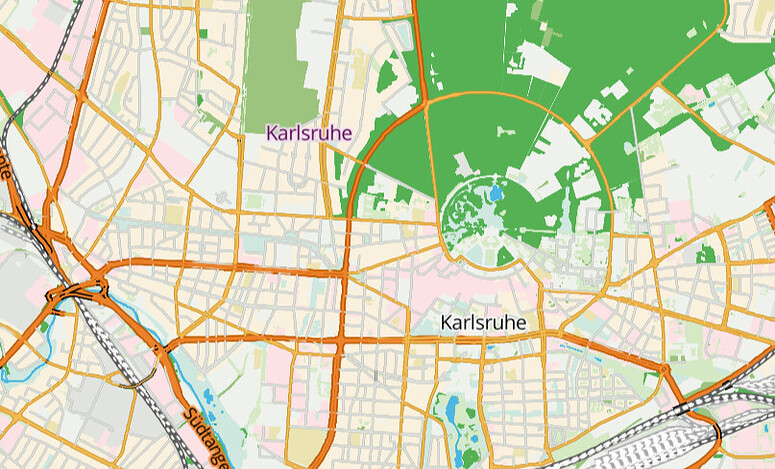
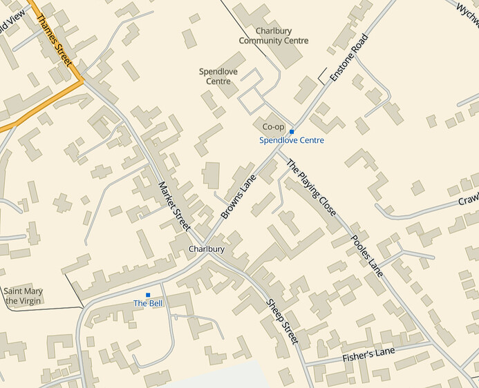
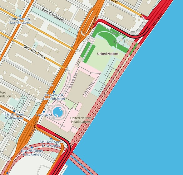
Posted by pnorman on 12 March 2023 in English.I have been developing Street Spirit, a new style using OpenStreetMap data. It uses Maplibre GL for client side rendering of MVTs generated by Tilekiln, which supports minutely updates using the standard osm2pgsql toolchain.
To focus style development, I have set its aims as being suitable for
- use as a locator map,
- to show off what can be done with OpenStreetMap data,
- to be up-to-date with the latest OpenStreetMap data, and
- using to orient a viewer to a location they are at.
Although not complete - if a style can ever said to be complete - it is at the point where there’s enough features to give the overall feel of the map, at least for zooms 12 and higher. Lower zooms are missing many features still, particularly roads and rail and some landcover and other fills.
Because the style has a more clearly defined purpose, I’ve been able to use more of the colour pallet than many other styles, particularly compared to styles designed for overlaying other data on top of.
I’ve set up a dev instance on one of my servers, using OSM data from 2023-02-27. Have an explore around.
Some of the bigger areas that need work are
- Missing mid- and low-zoom features
- Missing fills
- A consistent set of POI icons
- More POIs
If you’re interested in contributing to the work, let me know. Contributing will require some technical knowledge in the following areas
- MapLibre GL style specification, focusing on layers and expressions, including data-driven expressions;
- YAML, in particular appropriate indentation for arrays. MapLibre GL styles tend to feature deeply nested arrays; and
- SQL for writing read-only PostGIS queries if modifying vector tiles.
Discussion