rphyrin's Comments
| Post | When | Comment |
|---|---|---|
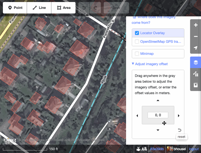
| New Esri World Imagery | @TonyJC Have you tried the “Imagery Offset” feature in the iD editor?
|
|
| New Esri World Imagery | Is there a new Esri World Imagery update? Did they announce it somewhere? |
|
| Skyranger 35 + OpenStreetMap Carto | Found it… Fulberg & Ochsenbodenstrasse (Unteriberg, Schwyz, Switzerland) |
|
| Skyranger 35 + OpenStreetMap Carto | Video link with timestamp : https://www.youtube.com/watch?v=orbzTpqlBok&t=35s I wonder if anyone can locate the actual location shown on that map using an advanced Overpass query. (I see bridges, rivers, roads, and peaks in the image. Can we create an Overpass query to check for all locations that contain these features nearby?) |
|
| The Take Off: LCCWG Sub-committee for OSMF Affiliation Models | The research team has drafted a report page here : osm.wiki/User:Rphyrin/LCCWG |
|
| OSM Progress timelapse videos with QGIS and Ohsome API | Really cool. I wonder if you could export and share those OSMCarto-like QGIS symbology settings so we can skip the time-consuming setup and benefit from your hard work instead 😂 |
|
| Please stop guessing about highway/waterway crossings | I wonder if there is even a surefire solution to fix the inherent problems that any ‘anyone can edit’ collaborative project (like this one) faces. Not everyone has enough resources to defend every inch of the content, whether against prank vandals or a very persistent good-faith editor (who was misled and actually caused significant damage to the project). The back-and-forth edit warring is exhausting and feels pointless. Also, not everyone has the mental stamina to prolong the conflict by reporting it to the available higher authority. Or maybe we could look up to more mature projects out there (like Wikipedia). Over time, they made the project less and less inclusive (only the trusted elites have the privilege to edit the content), all for the sake of quality assurance. |